Maps
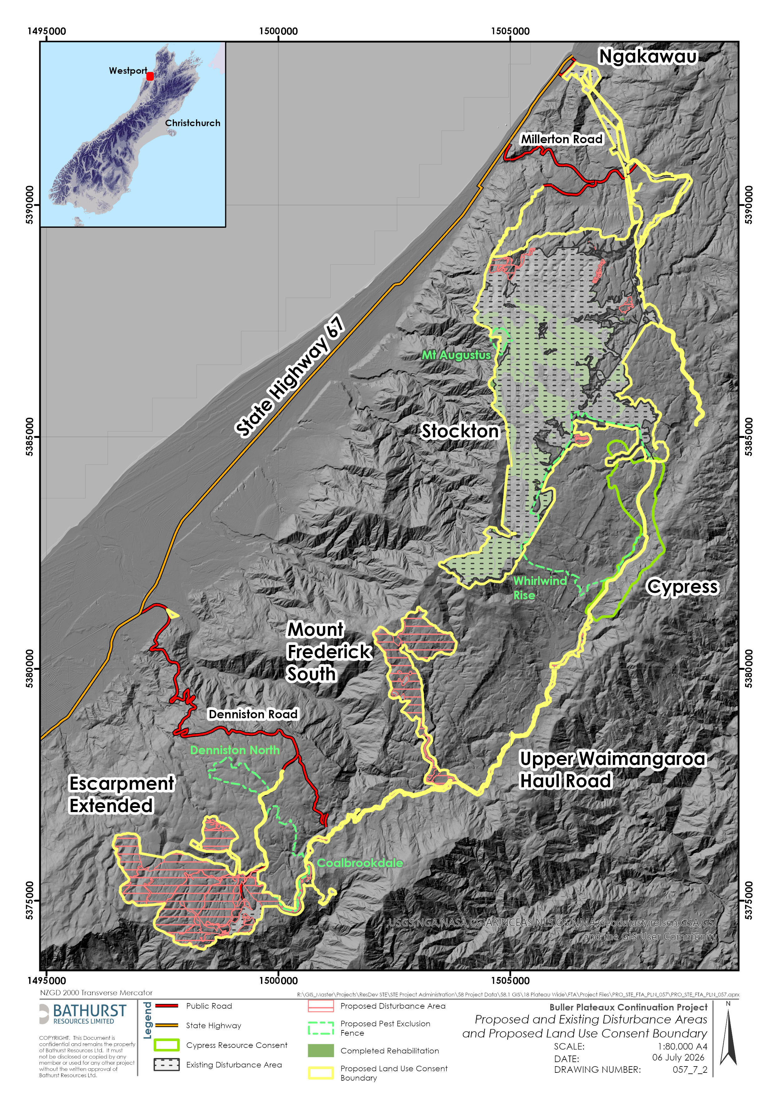
Visual reference for the project area and plans.
This page provides visual reference material for the Buller Plateaux Continuation Project, including the mine footprint, rehabilitation areas and surrounding land. Some maps are interactive and can be explored directly on this page, while others are available to download as PDFs for closer reference or printing.
Learn more from the Project Plans below